
Risk Solutions
Power your program with the world’s most advanced data analytics platform for agriculture
From supply chain interruptions to increasingly volatile weather, the effects of climate change are already impacting agriculture. Risk Solutions from Ceres Imaging offers insurers and lenders the advantage of finely tuned data models—refined by more than 11 billion individual plant-level measurements, captured over ten years and more than 40 crop types—to help you adapt to change.
- Increase efficiency of loss adjustments with automated damage reporting.
- Fast-track pre-inspection reporting and streamline underwriting with crop inventories.
- Improve claims responsiveness and accuracy after catastrophic events with portfolio insights.

Analytics tools for insurers and lenders
Your success relies on data that’s accurate, relevant, and easy to use. Ceres Imaging provides actionable insights to streamline daily tasks and guide your long-term strategy.
- Damage reporting
- Portfolio insights
- Crop inventories
- Plant-level insights
- Crop productivity forecast

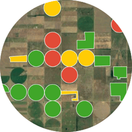 Portfolio insights
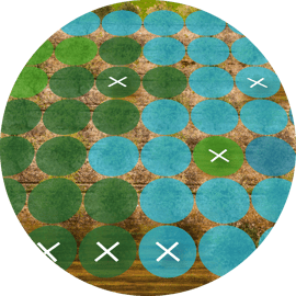
Crop inventories
Ceres provides automated reports with timely and accurate measurements of key farm characteristics, such as crop type, plant counts, tree diameters, crop vigor and planted acreage verification. Use crop inventories for pre-inspection reports, during underwriting, and for claims processing.

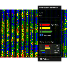 Plant-level insights
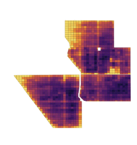
Unlike other providers that analyze data only at the regional or field level, Ceres delivers insights on portfolio performance down to the individual plant level. This enhanced precision unlocks the ability to quantify changes—so you can surface risk, uncover trends, and quantify changes over time.

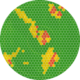
 Crop productivity forecast
The crop productivity forecast reveals where yield may be most impacted by stress. Use it to identify the most vulnerable areas of your portfolio, providing managers with localized data to forecast potential payouts, adjust risk models, and help farmers make timely changes in season to protect yield.
INTEGRATION PARTNERS
Ceres Imaging integrates seamlessly with farm management software and in-field sensors.

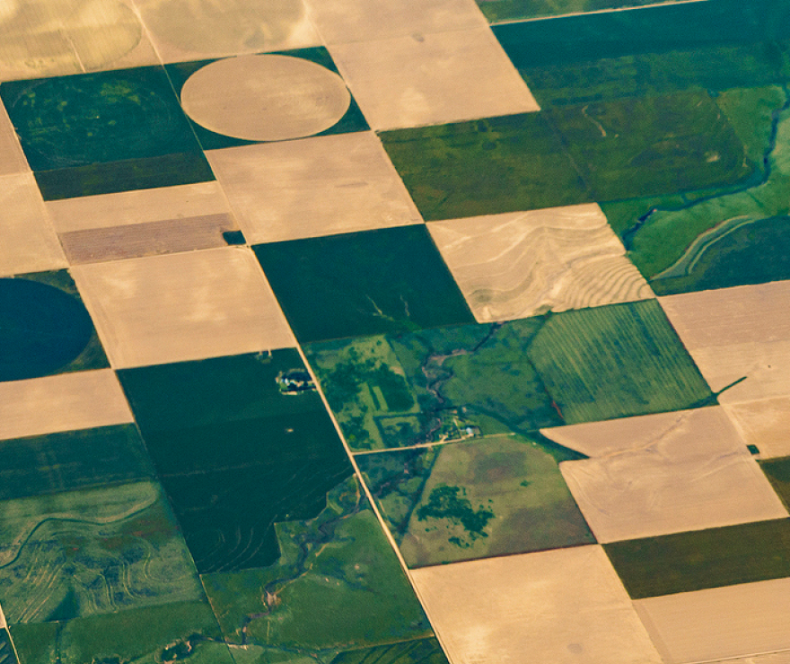
Best-in-class aerial imagery
Ceres Imaging is the industry leader in aerial data for agriculture, providing crop health data down to the individual plant level.

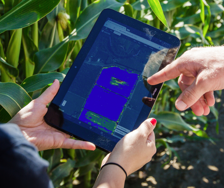
Mobile friendly
Easily refer to imagery in the field on your phone or tablet.

Customized for you
Pricing and service levels tailored to your operation.

![]()
