
Always included
.jpg?width=740&height=534&name=iStock-636670010%20(4).jpg)
Expert agronomic support
Benefit from agronomic support, project management services, and ongoing training help you put your data to work.
.jpg?width=740&height=534&name=iStock-636670010%20(3).jpg)
Flexible tasking
Need to capture imagery within 48 hours of a damage event, or plan around your irrigation schedule? We'll work with you to find the best imaging solution at the optimal time.
Reliable delivery
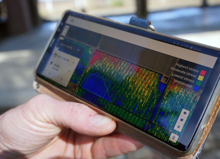
Ceres processes millions of acres annually and provides insights within hours of image capture. Access your data on a mobile device, tablet, or desktop computer.
Best-in-class aerial imagery
Ceres Imaging is the industry leader in aerial data for agriculture, providing crop health data down to the individual plant level.

![]()
