
Use of remote sensing for pest and disease management is technically nothing new: the practice of detecting outbreaks with aerial imagery has been documented as early as the 1920s. Though the technology that supports remote sensing has of course come a long way in the past 100 years, it can be difficult for growers to sort through the conflicting information about what’s currently possible—and practical—to achieve in the field.
Fourth-generation grower and Ceres Imaging remote sensing expert Kirk Steuve, PhD, recently shared his perspective at the Texas Plant Protection Association Conference. Kirk sees three key areas where remote sensing can be used for pest and disease management—with the technology and techniques for each area of use at a different level of maturity.
1. Targeted treatments for pest and disease outbreaks: 80% maturity
The area of pest and disease management in which remote sensing is consistently demonstrating value involves the targeted treatment of particular parts of the field—areas where the probability of pest/disease and substantial yield loss are high.
Regardless of the specific pest or disease threat, subtle variations in humidity, temperature, precipitation, and other environmental parameters—especially in crops with open or weak canopies—mean that some areas of a field are inherently more susceptible to outbreaks than others. Adding to the challenge, the location of these “hotspots” can change throughout the year.
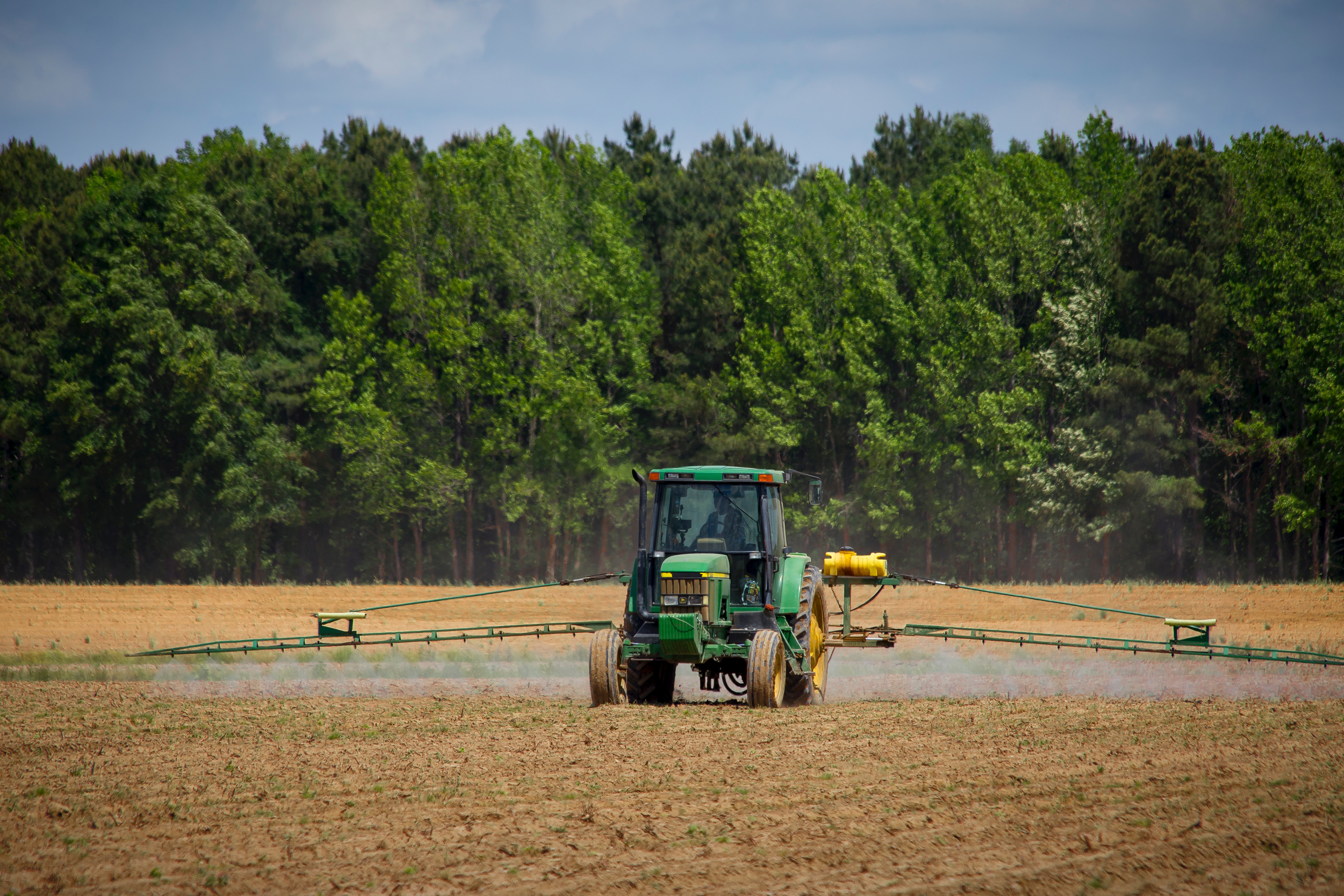
Aerial imaging with modern, scientific-grade thermal cameras like those used by Ceres Imaging can detect changes that indicate the presence of pests or disease. Remote sensing data that pinpoints potential trouble-spots, in combination with variable rate application (VRA) technology, allows growers to treat crops only in the spots where an application is absolutely needed. More advanced equipment, such as sprayers with sectional and even individual nozzle controls that sync with real-time kinematic (RTK) GPS—are enabling ever more precisely targeted applications.
In addition to lessening the environmental impacts of pesticide and fungicide use, the option to avoid blanket applications is an opportunity for significant cost savings—in some cases, the difference between a profitable season and one that threatens the operation. Kirk considers the use of remote sensing data for this pest and disease management almost fully mature and generally reliable.
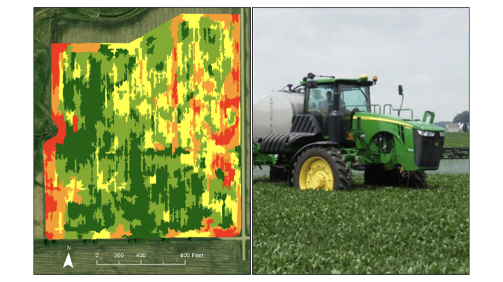 Above: Variable rate application of fungicide using a prescription from high-resolution imagery.
2. Comprehensive early detection of pest and disease outbreaks: 30% maturity
It’s well-established that aerial imagery can pinpoint areas likely to be affected by pest or disease and help growers minimize the costs of treatment. However, when it comes to early detection or prediction of these outbreaks, however, there’s still more work to be done.
Kirk points out that not all hotspots detected in aerial imagery are caused by pests or diseases. And even when they are, it’s not necessarily possible to identify exactly what’s causing crop stress based on remote sensing data alone—so those hoping remote sensing data will completely eliminate the need for scouting and ground-truthing are probably getting ahead of themselves.
3. Sampled early detection of pest and disease outbreaks: 15% maturity
In contrast to comprehensive early detection, which depends on aerial imagery of the entire area under analysis, sampled early detection involves capturing extremely detailed imagery from different portions of a field and extrapolating from these samples to draw conclusions about a larger area.
In theory, these almost microscopic views of the stem and leaf morphology can be used for automated pest, disease, and general stress identification. However, there are three key obstacles impeding development.
First, the methodology relies on algorithms powered by artificial intelligence that need further development before they can be considered reliable. Second, it is difficult to scale this approach to a production level where tens of millions of acres are targeted. Third, even when numbers one and two are achieved, network connectivity issues will impede adoption rates. Nevertheless, Kirk believes the early work has shown some promise and considers it an area of research to watch.
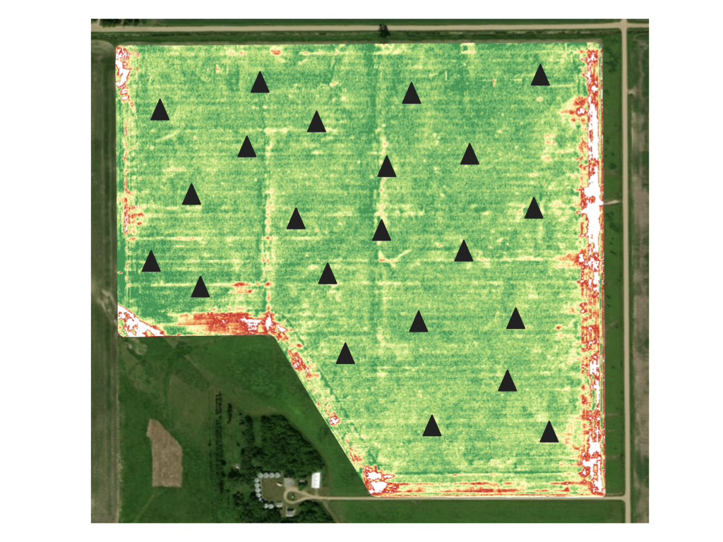
Above: Representation of a sampling scheme in a cornfield.
The bottom line for growers weighing the value of remote sensing for pest and disease management is that different applications of the technology are at different stages of maturity. In keeping with Ceres Imaging’s emphasis on research validation, Kirk advises fellow growers to be wary of claims that remote sensing data alone can accurately predict a specific pest or disease threat.
That said, gaps in the emerging science shouldn’t prevent growers from taking advantage of remote sensing where its value has been proven: identifying stressed areas of a field that may be vulnerable to pests or disease, detecting changes in plant health in time to stop the spread of the outbreak, and reducing costs by targeting treatment.
Industry trends Pest and disease Precision agriculture Research