
OUR SOLUTIONS
Sensor integrations
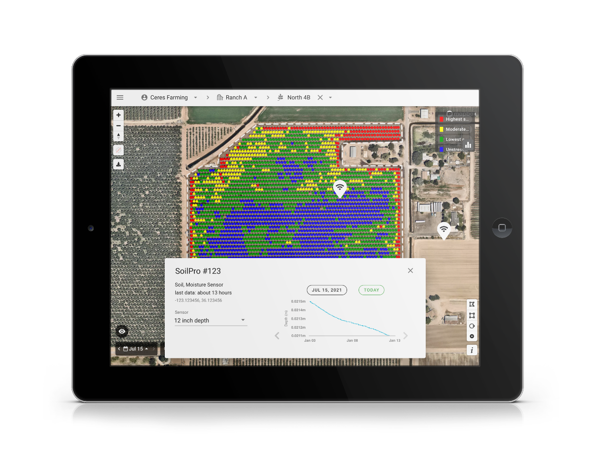
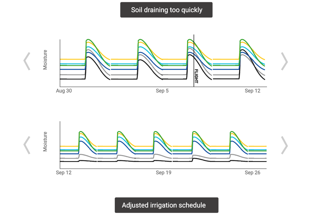
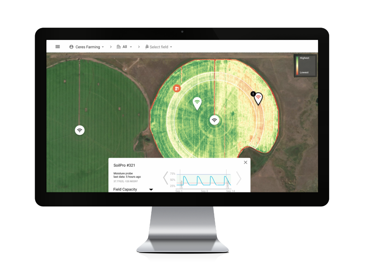
Optimizing irrigation depends on seeing the full picture of variability across your operation. That’s why Ceres Imaging offers seamless integrations with the in-field sensors you already use—including moisture probes and weather stations. With your farm data in one place, it’s easier than ever to uncover opportunities to improve uniformity and make the best irrigation decisions for your business.

![]()
