
If you're a longtime industry professional, you might remember some of the early days of aerial imagery for agriculture. Grainy satellite images offered a bird's-eye perspective—but they weren't much use for day-to-day farming decisions.
Today, advances in remote sensing technology mean that growers can use aerial imagery to detect irrigation issues and optimize water use.
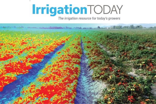
Ceres Imaging founder Ashwin Madgavkar discusses the evolution of thermal imagery for irrigation management in the Fall 2020 issue of Irrigation Today.
One of the biggest reasons to explain the rise in the use of imagery in irrigation management is the improvements in thermal image capture. Thermal image capture is used to measure crop temperature, which is critical in understanding crop water stress. Thermal imagery captured from the air makes the heat emitted from objects on the ground visible, revealing temperature differences that correspond to crop stress. Because water cools vegetation, thermal imagery is useful for detecting leaks, clogs and even some other irrigation issues.
Satellite-based imagery does not provide the most accurate measurements of thermal radiation reflecting off plants. Thermal imagery from satellites has 50- to 100-meter thermal pixels, which are not very helpful for farmers. Also, the water vapor and other atmospheric interference means that satellites have low thermal accuracy and are error prone. As a result, this is not seen as the best solution for thermal imagery capture by many experts. With the advent of plane- and drone-based image capture, some imagery companies have been able to generate highly accurate models of crop water stress showing relative temperature differences of 0.1 degree Celsius between plants.
To learn more and read the full article, visit Irrigation Today.