
As extreme weather events increase in frequency, insurance firms are partnering with agricultural technology companies to increase efficiency and accuracy in underwriting, fund designation, and claims assessments.
Several U.S. Approved Insurance Providers (AIPs) have announced strategic partnerships with agricultural technology companies since 2019. That's no surprise: in this data-heavy industry, technology can improve communication between customers and agricultural insurers, while also reducing risk.Ceres Imaging's Corey Feduck discusses the trend in the June issue of GIS Resources.
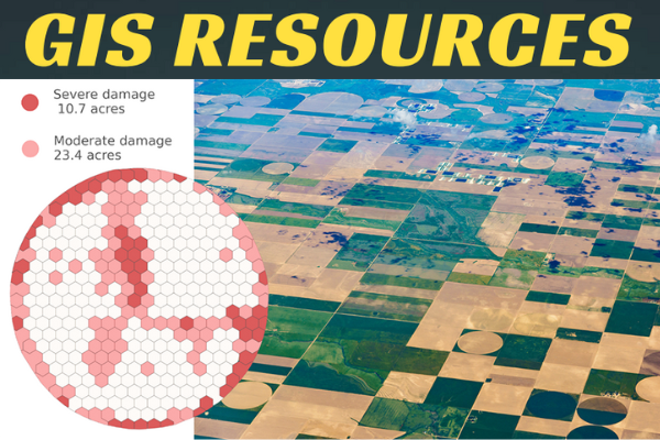
In addition to improving accuracy, aerial data also helps insurance providers quantify damage more quickly, reducing the cost of assessment and building stronger relationships with their customers.
As soon as crop damage has occurred, AI-powered analytics tools can be used to identify and quantify the damaged crops down to the acre or even the individual plant level—all within days of a damage event. Advanced thermal imaging from plane-based sensors also allows providers to capture certain longer-term yield impacts, such as water stress, 2-3 weeks before the issue becomes apparent to the naked eye.
Quickly quantifying the exact size and impact of a claim can help field teams manage their time and visits more effectively. For example, in a large hail event, there may be more claims in an affected region than there are representatives available to evaluate them. In this situation, an initial assessment completed via remote sensing allows providers to prioritize where field staff should go first.
To learn more and read the full article, turn to page 17 of the June issue of GIS Resources.